The Laurel Highlands Hiking Trail (LHHT), stretching over 70 miles, provides a diverse backpacking and hiking experience through Pennsylvania’s state parks and forests. The trail offers challenging terrain and stunning natural beauty, attracting hikers of all skill levels. This comprehensive guide offers essential tips, highlights key landmarks, suggests itineraries, and points out the best photo opportunities to enhance your adventure on the LHHT.
For personalized help planning your hike, reach out to Laurel Hill State Park at (814) 445-7725.
Essential Facts About the Laurel Highlands Hiking Trail
- Total Distance: 70 miles
- Location: Extends from Ohiopyle State Park to the Conemaugh Gorge, near Johnstown, Pennsylvania.
- Maintenance: The Laurel Ridge State Park Complex meticulously maintains the trail, including bridges over major creeks, ensuring year-round accessibility.
- Accessibility: The LHHT passes through several state parks in the Laurel Highlands with connector trails that offer options for day hikes, alternative routes, or early exits.
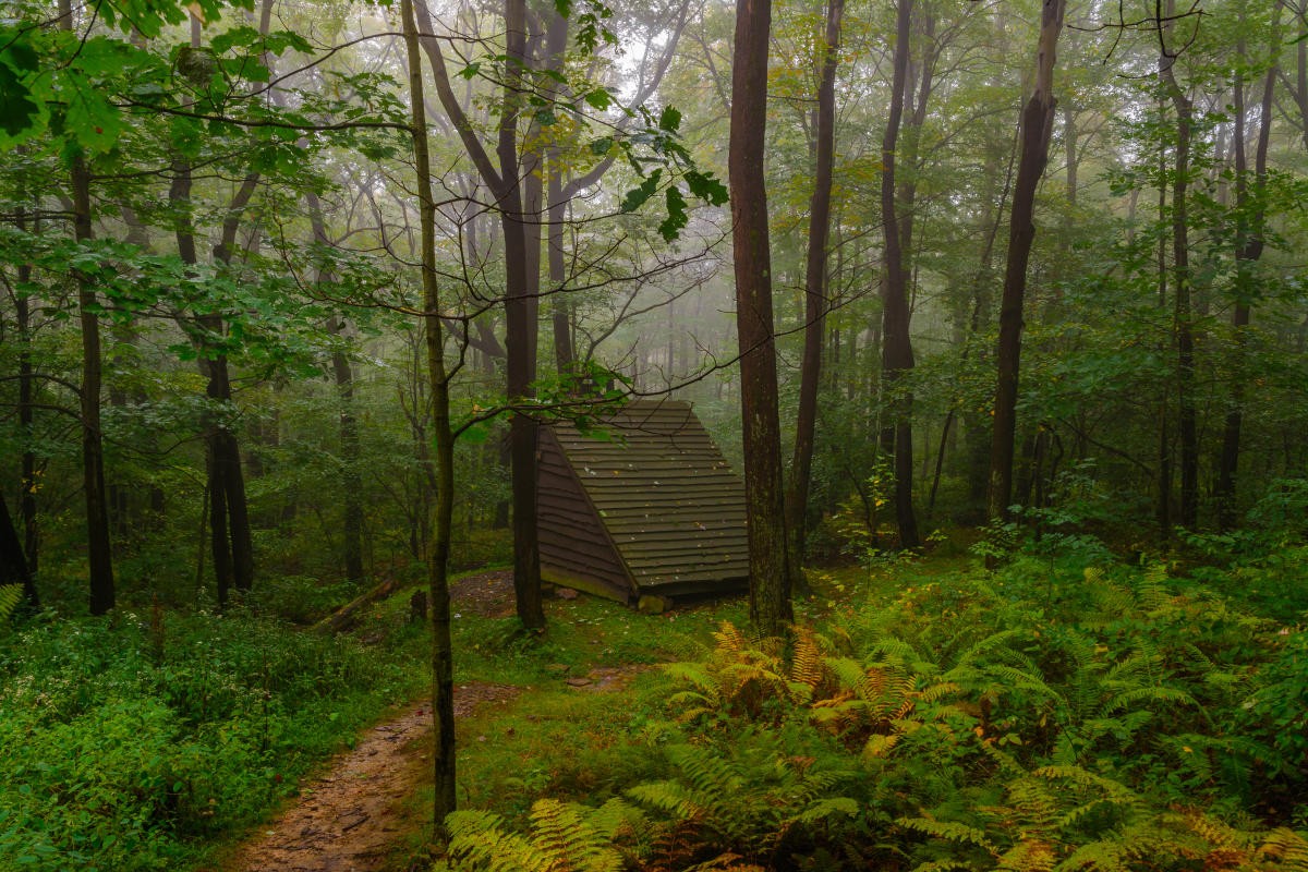
- Overnight Shelters: Eight shelter areas are spaced every 6-12 miles. Reservations are required, with a small fee. Reserve your spot at Pennsylvania State Parks.
- Shelter Amenities: Each overnight shelter features Adirondack-style shelters, tent pads, comfort stations stocked with wood, non-potable water, and pit privies for restrooms.
Must-See Photo Opportunities
The Laurel Highlands Hiking Trail is replete with unforgettable scenic views. Grab your camera and capture these iconic spots:
- Miles 7-8: Sugarloaf Knob: Offers a scenic vista from the third-highest point in Pennsylvania.
- Miles 12-13: Cranberry Glade Lake: A stunning 112-acre lake, particularly beautiful in the fall.
- Mile 21.5: Middle Fork Rock Outcropping: Enjoy panoramic views of the Laurel Highlands.
- Mile 24.5: Blue Hole Creek: A refreshing spot for a quick dip.
- Mile 27: Highest Point: Reaches 2,961 feet above sea level.
- Mile 29: Seven Springs Mountain Resort: A spectacular view as the trail crosses the slopes.
- Mile 36.5: Pennsylvania Turnpike Bridge: Experience the unique perspective from the bridge crossing.
- Near Mile 41: Beam Rocks: Impressive 90-foot rock formations popular for climbing.
- Miles 67-69: Conemaugh River and Johnstown: Multiple vantage points to view the river and city.
Laurel Highlands Hiking Trail Itinerary Suggestions
LHHT for Beginners: A Perfect Day Hike
For those new to the LHHT, this day hike offers a taste of the trail’s best features without extreme elevation changes, along with convenient bailout options.
- Start: Park at Laurel Ridge State Park, located off Route 30. This puts you at approximately mile 46 on the LHHT map.
- Route: Head south on the trail toward Forbes State Forest.
- Highlights (Mile 40): Visit Beam Rocks and Spruce Run, two of the most popular spots on the trail.
- Detours:
- Spruce Flats Bog: A short detour from mile 40 leads to this bog, home to insect-eating plants.
- Laurel Summit: Offers a commanding view at 2,739 feet above sea level.
- Wolf Rocks: Another excellent rock climbing location.
- Return: Hike back to your car, or arrange for shuttle pickup with Wilderness Voyageurs or Coal Tubin’.
LHHT for Experienced Hikers: The Ultimate Challenge
Experienced hikers seeking a challenge can test their limits on the Laurel Highlands Hiking Trail. Try an out-and-back trip to conquer 140 miles of diverse terrain or attempt trail running, covering as much of the LHHT as possible in a single day with minimal gear. For a group challenge, participate in one of the organized LHHT events.
Events on the Laurel Highlands Hiking Trail
The LHHT hosts various events annually, catering to both seasoned hikers and newcomers. The Laurel Highlands Ultra is a 70.5-mile race for individual and relay teams. The Crucible is a three-day extreme hike covering the entire 70 miles with a full gear pack, benefiting veterans. Find more events on the Laurel Highlands events calendar.
Resources for Your Hike
The Laurel Highlands community is ready to support your LHHT adventure. Visit the DCNR website for maps, shelter reservations, and general information. Gear up and arrange shuttle services to any LHHT trailhead with Wilderness Voyageurs.